|
The Harris Map Collection
Dr.
Harris found the first of the Harris Maps in an antique shop
in Korea in 1972. He immediately located Fu Sang on the map
and recognized the map's connection to the ancient Chinese
geography the Shan Hai Jing. The legendary Fu Sang is
right where America should be. In 1981 Harris died of a
stroke. His collection of seven map books was left to his
seven children who still collectively own it.
1981
Harris died of a stroke leaving his collection of seven map
books to his children.
From 1981 until 2003 most of the time the
Harris collection was just in a box under the bed of Hendon,
III. The heirs dared not believe that what their father said
about them was correct.
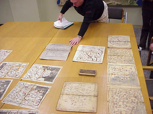
Hendon M. Harris III showing a part of the Harris Map
Collection
In 2003 there was a flurry of worldwide
debate about whether the Chinese arrived in America before
Columbus. At that time the Harris family took the maps to the
Library of Congress where they remained for three years while
they were being studied.
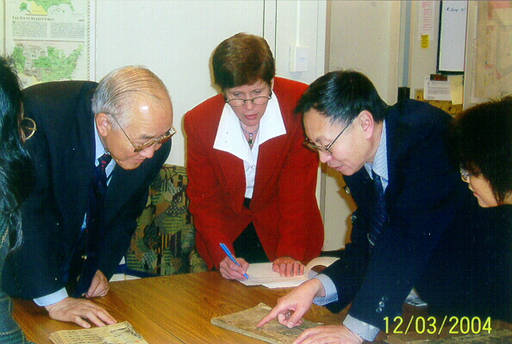
Dr. Hwa-Wei Lee, Chief, Asian Division,
Library of Congress, Charlotte Rees, and
Dr. Xiaocong Li,
Vice Director of Centre for the Ancient Chinese History
Studies,
Peking University viewing the Harris Maps at the Library of Congress
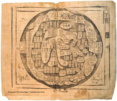
The History of Cartography, to which
Charlotte was directed at the Library of Congress, states that
the date of origin of this style map is unknown. It further
tells that 72 percent of the place names on this map are from
the Shan Hai Jing. However, the History of
Cartography contends that
while China, Korea, and Japan in the center of the map are
real those countries on the outer rim are imaginary.
Harris believed that the additional place
names were added during the many times the maps were copied
over the years. He believed that the "mother map" of this
style was the long lost map that at one time accompanied the
Shan Hai Jing. That would make the original copy of the
map to be from 2200 B. C.
By the time of his death Dr. Harris was
aware of 23 other similar maps of this style (in addition to
his seven) in prestigious
museums and collections around the world. He correctly
surmised that there were probably a few more. In effect, the
true meaning of these maps has been hidden for years - right
in plain sight.
The Harris maps were printed from wood
block. Most are on mulberry-bark paper and are written in
classical Chinese. Although varying in ages they have only minimal differences. The oldest of the Harris maps are believed to
be from the Ming dynasty. The map books themselves are Korean but the world map in
each book is a Chinese map.
Click the map above for a higher resolution
image
|